Map the corridor
See transmission, substation, highway, fiber-evidence, and land-screening context together.
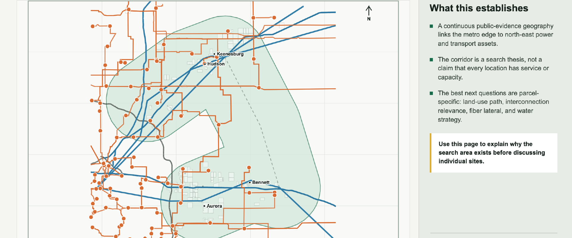
Eastern Denver metro corridor
Public-evidence site intelligence for large-land infrastructure opportunities.
A disciplined first screen
LandMain brings public power, fiber, access, land, water-context, environmental, and policy evidence into one comparable screening workflow. The current demonstration covers Watkins and Bennett north through Hudson and Keenesburg.
See transmission, substation, highway, fiber-evidence, and land-screening context together.
Review five representative opportunities against the same evidence model and confidence language.
Separate encouraging proximity from the capacity, service, entitlement, control, and engineering questions that require verification.
Presentation library
Use the interactive view for exploration or open a fixed-format document for a meeting.
Corridor backbone, ranked opportunity field, parcel evidence, and confidence constraints.
Open PDFFive standardized local map sheets with evidence, caveats, and the next gate.
Open PDFAn eight-slide narrative for a short external conversation.
Open PPTXThe briefing deck with presenter notes for live delivery.
DownloadEvidence boundary
Public-evidence proximity, comparative fit, mapped constraints, dated market signals, and explicit next diligence gates for representative screens.
Utility capacity, carrier service, entitlement, water availability, buildable acreage, site control, or investment viability. Representative screens are not listings or offers.